
The "Bromley" Brooklyn Atlas is a great resource for armchair historians. The Atlas was published every few years from the late 19th into the 20th centuries, and the New York Public Library has many of them online here. (Unfortunately the library's viewing application is cumbersome and rather like trying to view the Grand Canyon while looking through a mailing tube.)
The Bromley Atlas is particularly valuable for building researchers because it shows lot lines and even individual buildings. What's more, the buildings are color-coded by material, with "brick" buildings in pink, and "wood" buildings in yellow.

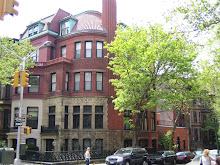
We've spent the past few weeks reviewing the 1880 Bromley Brooklyn Atlas, and have recorded our findings in our ongoing Documentary History of the Park Slope Historic District Expansion Area (streets, avenues), and also in the photo captions of our comprehensive photo archive. We have already compiled a lot of research gleaned from sources like the Brooklyn Eagle and the American Architect & Building News. But, of course, there were gaps. The Bromley Atlas can at least tell us whether a building was standing by 1880 or not, which helps to fill out the history of Park Slope.
We will review some of our Bromley findings in subsequent posts.
No comments:
Post a Comment